EuroCropsML
Ready-to-use benchmark dataset for few-shot crop type classification using Sentinel-2 imagery.
Release vUNRELEASED
EuroCropsML is a pre-processed and ready-to-use machine learning dataset for crop type classification of agricultural parcels in Europe.
It consists of a total of 706,683 Sentinel-2 multi-class labeled data points with a total of 176 distinct classes.
Each data point contains an annual time series of per parcel median pixel values of Sentinel-2 L1C (top-of-atmosphere) reflectance data for the year 2021.
The dataset is based on Version 9 of EuroCrops, an open-source collection of remote sensing reference data.
For EuroCropsML, we acquired and aggregated data for the following countries:
Country |
Number of distinct classes |
Total number of datapoints for Sentinel-2 |
|---|---|---|
Estonia |
127 |
175,906 |
Latvia |
103 |
431,143 |
Portugal |
79 |
99,634 |
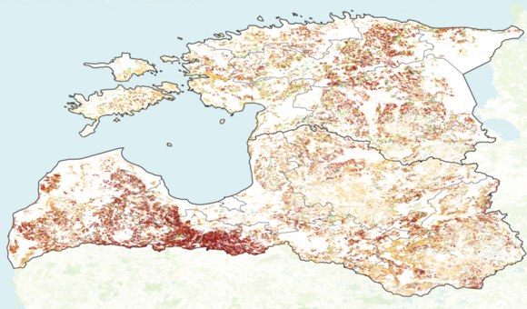
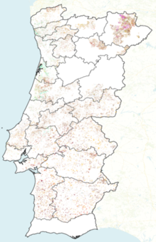
The distribution of class labels differs substantially between the regions of Estonia, Latvia, and Portugal. This makes transferring knowledge gained in one region to another region quite challenging, especially if only few labeled data points are available. Therefore, this dataset is particularly suited to explore transfer-learning methods for few-shot crop type classification.
The data acquisition, aggregation, and pre-processing steps are schematically illustrated below. A more detailed description is given in the dataset section of our documentation.
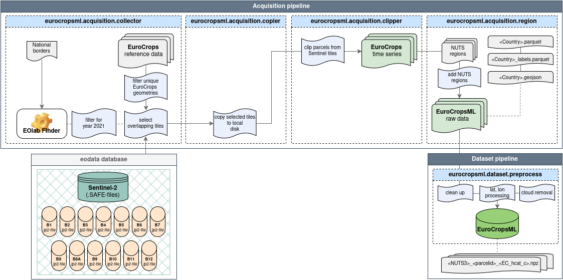
Table of Contents
📖 References
🚩 Project Links